NatureScot Peatland ACTION has launched the first interactive peatland restoration data mapping portal of its kind in Scotland.
It offers users access to a wide range of data and analysis tools. You can view completed peatland restoration projects across the country, as well as feasibility studies and details of peat depths and condition surveys. It allows you to zoom in and out of the map, pan to different locations, and select different data layers to explore.
The portal also includes tools to download datasets, querying data, and creating custom maps. Peatland ACTION are also planning to add hydrological monitoring results such as water table depths to the portal.
Visit the Peatland ACTION data mapping portal to find out more, including tips on how to use the tool, and how to acknowledge any maps or any other visuals you produce.
The tool is just one of a range of resources available through the Peatland ACTION website www.nature.scot/peatlandaction
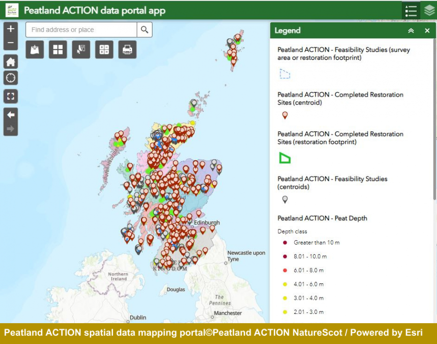
Image caption: A peek at the NatureScot Peatland ACTION spatial data mapping portal. Photo credit: ©Peatland ACTION NatureScot / Powered by Esri

