The Land Cover Map created by the Moors for the Future Partnership to help monitor on-going conservation works is featured on the Ordnance Survey (OS) website.
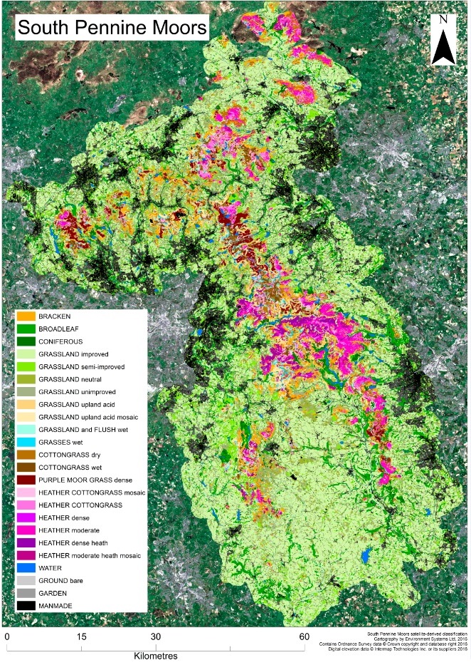 As well as identifying areas that have become dominated by single species, the Land Cover Map will aid the planning of land management and restoration works, and provide a baseline for monitoring the delivery, impacts and outcomes of the MoorLIFE 2020 project.
Read more: www.moorsforthefuture.org.uk/news/land-cover-map-ordnance-survey-case-study

