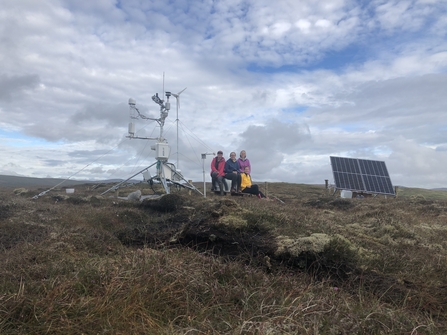
Developing, validating and verifying the Peatland Code or other peatland restoration projects can be a challenge! A consortium of UK researchers, based at The James Hutton Institute, UK Centre for Ecology and Hydrology, and the Universities of Exeter, Nottingham, Leeds and the Highlands and Islands, are developing a variety of Earth Observations-based tools to locate areas of damaged peatland, identify their condition and monitor changes in condition including water table depth dynamics through time.
Through the pan-European MOTHERSHIP project and the Scotland-focused CentrePeat and Supporting Land Use Transformations projects, these teams are working on tools for peatland depth and peatland condition mapping, and on tools for the purpose of monitoring, reporting and verification (MRV) of restoration.
In these projects, impacts of future climate change scenarios are also being investigated, via process and land surface model development. If you are interested in becoming involved in helping to develop, or test, these products, particularly if you are involved in project development, validation, verification, or your projects host water level or greenhouse gas monitoring equipment, please contact the MOTHERSHIP and CentrePeat project co-ordinator Rebekka Artz for more information (rebekka.artz@hutton.ac.uk).

